Countries that cross the equator line
|
NEWS
Source: listas.20minutos.es
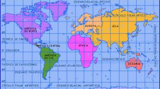
It bears this name not because this is the only country crossed by the line, but it is the highest point and because of its characteristics there the necessary studies were carried out to measure the curvature of the earth and other measurements. The other countries crossed are: Colombia and Brazil, 7 African countries (Sao Tome and Principe, Gabon, Congo, Democratic Congo, Uganda, Kenya and Somalia), 2 Asian countries (Maldives and Indonesia) and 1 oceanic country (Kiribati).
TOP 17:
Kiribati
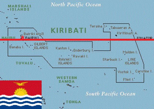
But it does not pass through any of the Gilbert Islands, but if passing 21 km south of Baker Island at the coordinates 0 ° 0′N 129 ° 21′E.
TOP 16:
Nauru
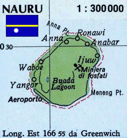
Its coordinates are 0 ° 0′N 129 ° 21′E, passing 42 km north of Nauru.
TOP 15:
Federated States of Micronesia
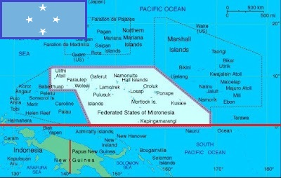
The Federated States of Micronesia is an independent country located in the Pacific Ocean, northeast of Papua New Guinea, in the Micronesia region. The Federated States of Micronesia consist of 607 islands that extend along the Carolinas Islands archipelago, east of the Philippines. The four groups of islands that constitute them are Yap, Chuuk (called Truk until January 1990), Pohnpei (called Ponape until November 1984), and Kosrae. The federal capital is Palikir, in Pohnpei. Virtually all of the islands are atolls and coral reefs seated on underwater mountain ranges, and in many cases ancient volcanoes as is the case in Chuuk, the perimeter of the lagoon of such atoll being the emergence of corals settled on a volcanic crater. The Ecuador line is located on the southern border of Micronesia.
TOP 14:
Kenya
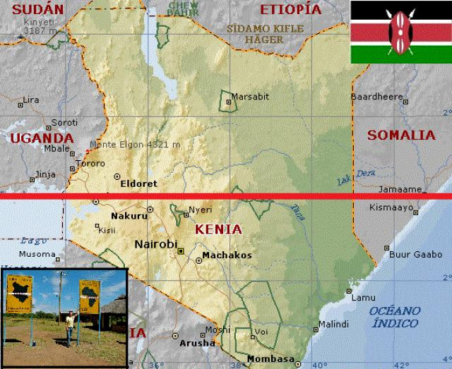
It passes 6 km north of the center of Kisumu, at the coordinates 0 ° 0′N 34 ° 0′E.
TOP 13:
Maldives
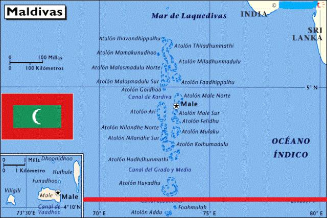
But it does not pass through any of its islands directly, but it does pass between the Huvadhu and Fuvahmulah Atolls, at the coordinates 0 ° 0′N 42 ° 53′E.
TOP 12:
Somalia
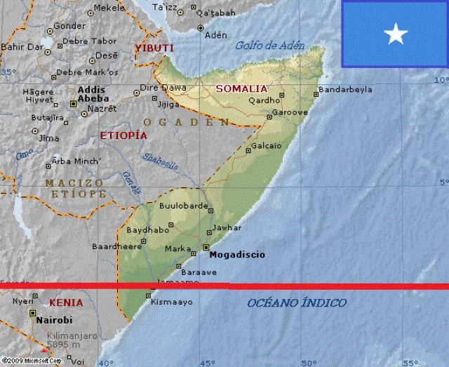
Its coordinates are 0 ° 0′N 41 ° 0′E, south of Somalia.
TOP 11:
Democratic Republic of Congo
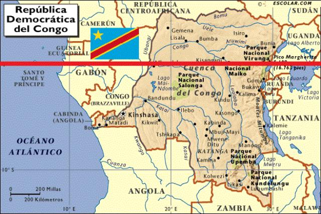
Its coordinates are 0 ° 0′N 17 ° 46′E, passing 9 km south of downtown Butembo.
TOP 10:
Indonesia
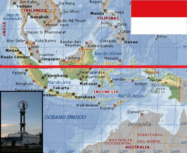
It crosses many islands, of which are Sumatra, Batu Islands, Lingga Islands, Sulawesi, Borneo, Kayoa, Halmahera, Gebe Island and the Karimata and Makassar Straits, between the coordinates 0 ° 0′N 98 ° 12′E and 0 ° 0′N 129 ° 20′E. Also passing 570 m north of Waigeo Island, Indonesia.
TOP 9:
Jarvis Island (United States)
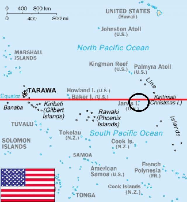
Jarvis Island (also known as Bunker Island) is an uninhabited coral island of 4.5 km², located in the South Pacific Ocean, halfway between Hawaii and the Cook Islands. It is located in the central part of the islands of the Line. It is an unincorporated territory of the United States, and is administered from Washington DC. The coordinates are 0 ° 22.7′S 160 ° 1′O.
TOP 8:
Singapore
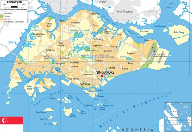
Singapore, officially the Republic of Singapore is an island sovereign country of Asia, formed by sixty-three islands, whose form of government is the parliamentary republic. Its territory is divided into five Community Development Councils. Its capital is the City of Singapore, so Singapore is considered a city-state. Its coordinates are 1.3 ° N 103.8 ° E
TOP 7:
Gabon
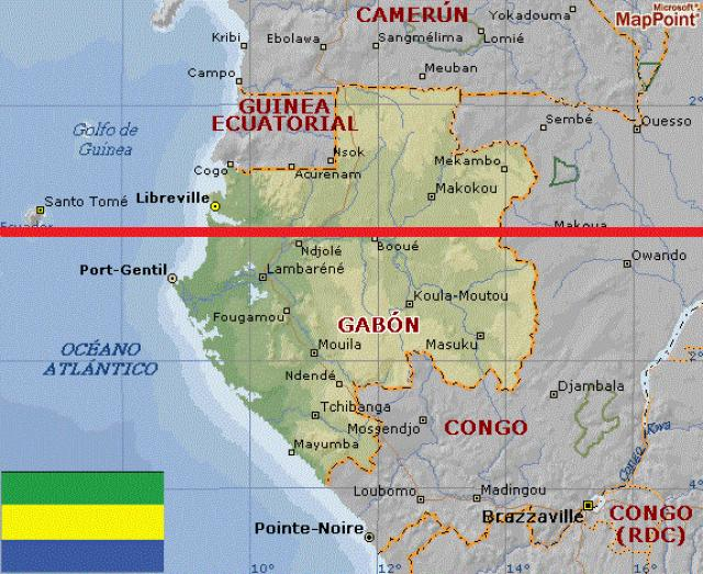
Its coordinates are 0 ° 0′N 9 ° 21′E, almost to the center of Gabon.
TOP 6:
Republic of Congo
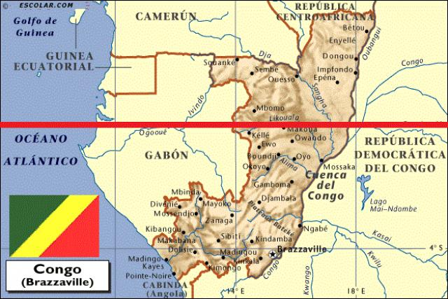
Its coordinates are 0 ° 0′N 13 ° 56′E, passing through the city of Makoua.
TOP 5:
Uganda
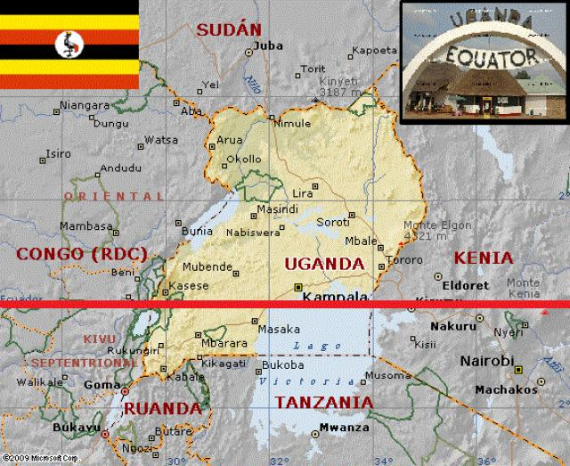
Its coordinates are 0 ° 0′N 29 ° 43′E, passing 32km south of the center of Kampala. Also some islets on Lake Victoria, at the coordinates 0 ° 0′N 32 ° 22′E.
TOP 4:
Sao Tome and Principe
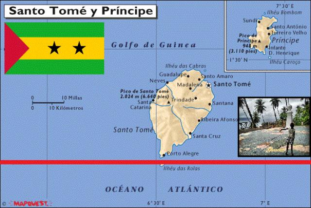
Its geographical coordinates are 0 ° 0′N 6 ° 31′E, passing through Ilhéu das Rolas, a small island of that archipelago. Ilhéu das Rolas is an islet that belongs to the country of Sao Tome and Principe, in the Gulf of Guinea, is the third largest in the entire country. The islet is located south of the coast of the island of Santo Tomé, at 0º N 6º W. It is known for being on the equator and has beaches, palm trees, a lighthouse and a tourist hotel. There is a permanent population of only 200 people.
TOP 3:
Brazil
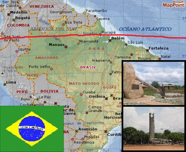
Passing through Amazonas, Roraima, Pará and Amapá, also on some islands at the mouth of the Amazon River, located at coordinates 0 ° 0′N 70 ° 3′W.
TOP 2:
Colombia
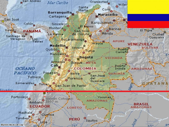
Its coordinates are 0 ° 0′N 75 ° 32′W, passing 4.3 kilometers north of the border with Peru.
TOP 1:
Ecuador
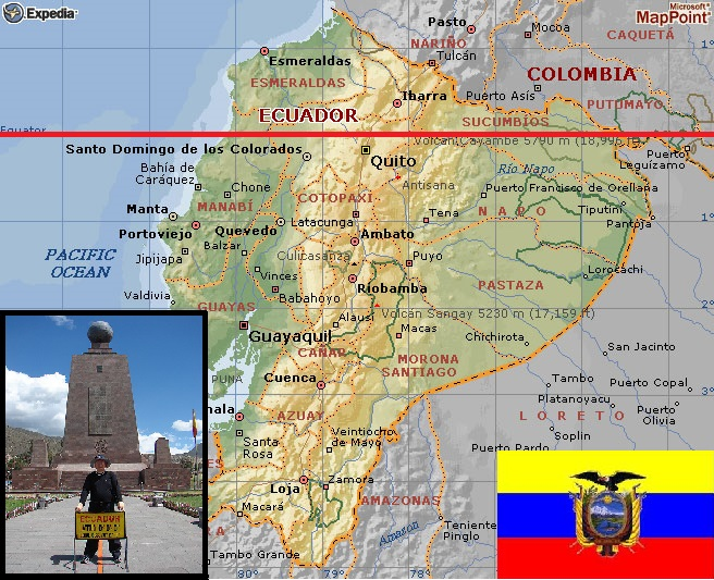
Its coordinates are 0 ° 0′N 80 ° 6′W, passing 24km north of downtown Quito near the Middle of the World, which is a property owned by the prefecture of the province of Pichincha, Ecuador. It is located in the parish of San Antonio of the Metropolitan District of Quito, north of downtown Quito. However, the entire structure is really 240 meters south of the true equator thanks to the appearance of GPS technology, which was not located until the 20th century. It is located on the parallel 0º 0 '7.83 "South latitude (240 meters approximately towards the South of the true Geographic Ecuador). Also the Isabela Island of the Galapagos Islands, whose coordinate is 0 ° 0′N 91 ° 35′W.


